January e-Newsletter Community Guest Spotlight with Masoumeh Hashemi
Posted Jan 7, 2026
Masoumeh Hashemi, Graduate Research Assistant, Plants, Soils & Climate Department, S.J. & Jessie E. Quinney College of Agriculture & Natural Resources, Utah State University
Water resources pose significant challenges for policymakers, water managers, and other stakeholders across a wide range of contexts, from flood mitigation to drought management. Regardless of the specific application, accurately measuring water flow and water levels across different spatial scales and water-use types is fundamental. Simply put, without measurement, effective management is impossible.
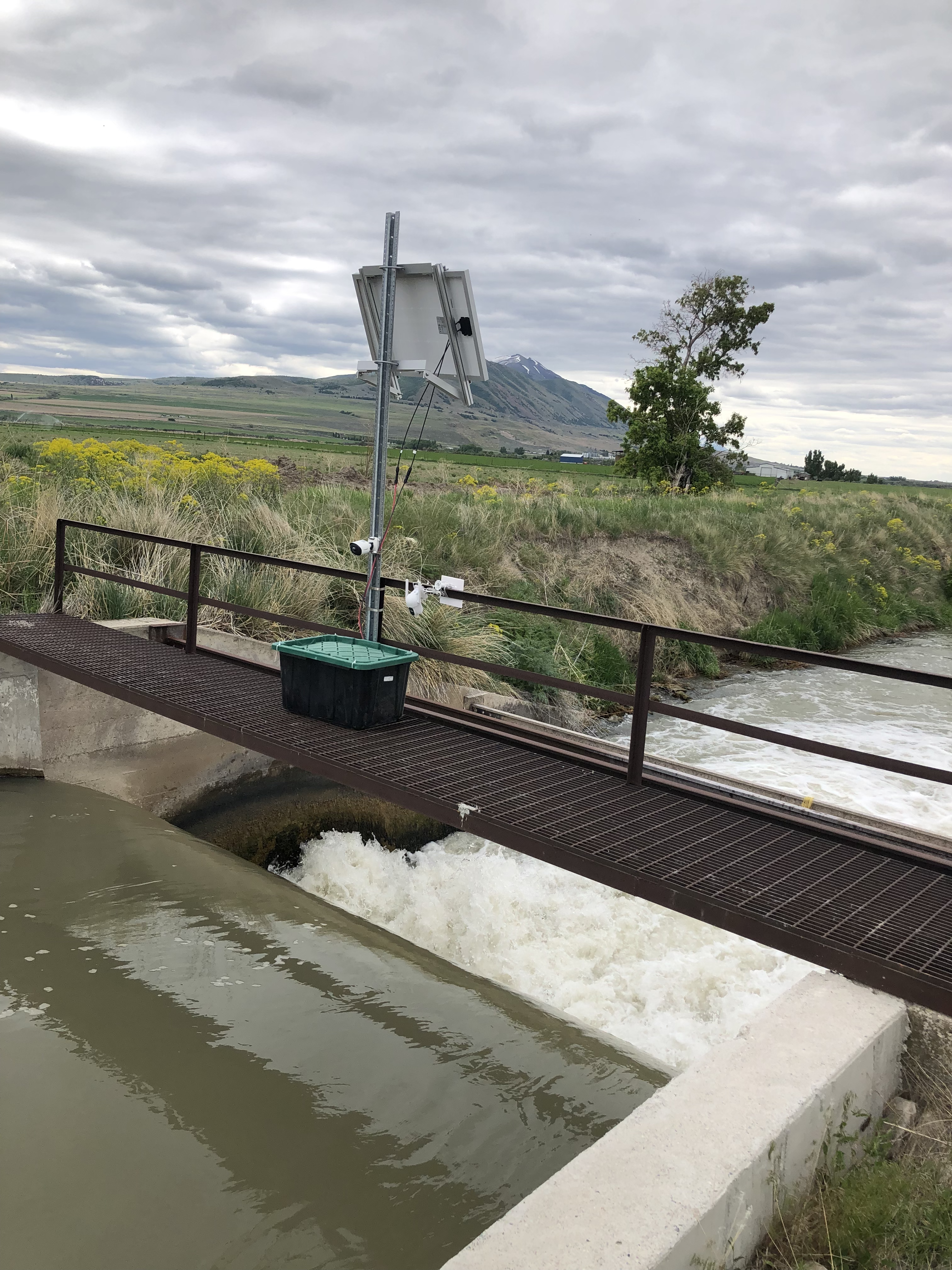
Irrigation canals and ditches are essential infrastructure for agricultural productivity and water equity, but many of these systems lack adequate monitoring. Existing technologies are often costly, power-intensive, or require manual measurements, limiting real-time data availability. As a result, many irrigation networks remain under-monitored, constraining effective water management and decision-making.
Early exposure to deep learning in image processing inspired me to explore its applications in hydrology, with a long-term focus on irrigation networks. This goal was driven by firsthand experience in a system serving over 2,000 farmers, where unequal water distribution and the lack of real-time, data-driven monitoring led to persistent conflicts and yield disparities. The absence of transparent, dense water measurements also limited effective decision-making by canal companies and state agencies.
In response to these challenges, our team at Utah State University is working to develop a low-cost, real-time, and scalable approach for measuring water level and surface velocity in agricultural canals and ditches. We are exploring the use of inexpensive camera systems, including low-resolution cameras, combined with image processing and computer vision techniques to estimate key hydraulic variables.
The study focuses on two complementary applications: (1) integrating camera-based systems at sites with existing staff gauges to enhance and automate water-level measurements, and (2) deploying cameras in canal and ditch locations where no gauges currently exist, thereby enabling monitoring in previously unmeasured sections of the irrigation network. These approaches allow both validation of the camera-based methods and expansion of monitoring coverage across the system.
This work represents one of the first demonstrations of camera-based techniques for estimating discharge in agricultural canals and ditches. By providing affordable, real-time measurements, the proposed approach has the potential to improve irrigation management, support water accounting, and enhance transparency for farmers and water managers alike, ultimately strengthening data-driven water governance in water-scarce regions.